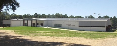
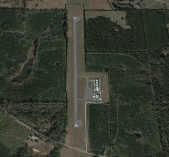
Paul Pittman Memorial Airport
|
141 AIRPORT ROAD
TYLERTOWN, MS 39667 Phone 601-876-9327 MARY F GARNER, 601-876-5173 CHAIRPERSON AIRPORT BOARD |
|
FAA Identifier:
T36
Lat/Long: 31-08-45.6400N / 090-10-05.3220W
31-08.760667N / 090-10.088700W
31.1460111 / -90.1681450 (estimated)
Elevation: 384 ft. / 117 m (estimated)
Variation: 03E (1985)
From city: 3 miles NW of TYLERTOWN, MS
Zip code: 39667
Airport Communications:
CTAF/UNICOM: 122.8
Beacon: white-green (lighted land airport)
Runway edge lights: medium intensity
Runway Information: Runway 18/36 Dimensions: 3000 x 60 ft. / 914 x 18 m
Surface: asphalt, in good condition
Weight limitations: Single wheel: 20000 lbs
Visit AIRNAV for the latest information
Surface: asphalt, in good condition
Weight limitations: Single wheel: 20000 lbs
Visit AIRNAV for the latest information
RUNWAY 18 RUNWAY 36
Traffic pattern: Left Left
Gradient: 0.9% 0.9%Markings:
Markings: Basic, in good condition Basic, in good condition
Visual slope indicator:
2-light PAPI on left (3.00 degrees glide path) 2-light PAPI on left (3.00 degrees glide path)Obstructions: 50 ft. trees, 1510 ft. from runway None
26:1 slope to clear
Airport Services:
Fuel: 100LL - FUEL AVAILABLE 24 HRS WITH CREDIT CARD
Parking: tiedowns
Bottled oxygen: NONE
Bulk oxygen: NONE
Aircraft based on the field: 12
Single engine airplanes: 12
Aircraft operations: avg 31/day
57% local general aviation
43% transient general aviation
* for 12-month period ending 22 May 2015
PUBLIC TELEPHONE 601-876-9327
Instrument Procedures: There are no published instrument procedures at T36.
Nearby airports with instrument procedures:
KMCB - Mc Comb (Pike County) John E Lewis Field Airport (16 nm W)
0R0 - Columbia (Marion County) Airport (20 nm NE)
KBXA - George R Carr Memorial Air Field (Washington Parish) (25 nm SE)
M43 - Prentiss - (Jefferson Davis County) Airport (30 nm NE)
1R7 - Brookhaven- (Lincoln County) Airport (30 nm NW)Airport Operational Statistics